Clachan Power Station
OS Grid Ref: NN 19210 13310(access tunnel portal)
Date opened: 1956
Date closed : Operational
The Shira scheme is one of the Hydro's more interesting experiments. A
complex little scheme, it was built over a long period (started 1948, finished
1959), and it featured the first experiment with pumped storage in the
UK, at Sron Mor, and the most powerful single turbine installed in the
UK, at Clachan. Although Shira was built and operated as a single scheme,
I've split the discussion on these pages up by power station, so this section
will concentrate entirely on Clachan.
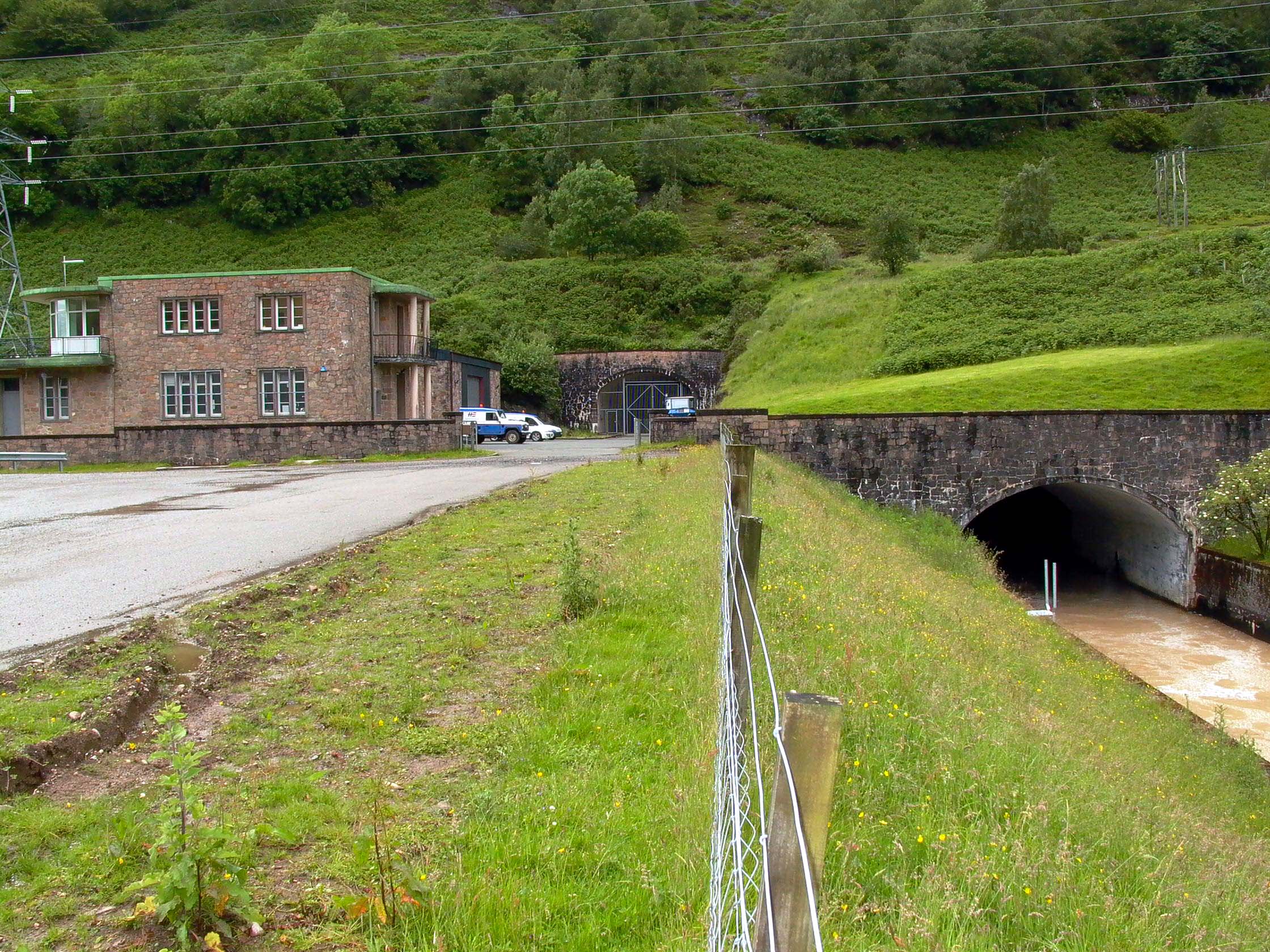
Clachan itself is a high-head (960ft) development of the 'traditional'
kind (dam, low-pressure tunnel, surge shaft, high-pressure shaft/tunnel,
power station, short tailrace). Storage is provided at Lower Loch Shira,
which has been created by two dams, one gravity, one earthfill, situated
in a gorge downstream of the Sron Mor/Upper Loch Shira section. Lower Loch
Shira receives the discharge from Sron Mor power station, which is in turn
supplied from the main storage reservoir of the scheme at Loch Shira.
Water is taken from an intake structure adjacent to the Lower Shira dam
into the low pressure tunnel, 6 miles long by 11' in diameter, to the junction
with the expansion chamber, inclined surge shaft, and surge pond. From
there the water falls down a steel-lined high-pressure shaft, inclined
at 39º, at the base the shaft becomes level, and turns to lead to the MIV
at Clachan power station. Clachan was constructed (just) underground, using
the 'cut & cover' method. After passing through the turbines at Clachan,
a short tailrace tunnel leads to a long tailrace canal, which discharges
the water into the river Fyne close to the point where the river enters
the sea at the head of Loch Fyne.
The water from the Lower Shira reservoir is supplemented to a considerable
degree by two major systems of aqueducts and diversion tunnels; the Kilblaan
section leads water into the top of the surge shaft, the Brannie section
water flows into the main tunnel where it surfaces briefly to cross the
Brannie Burn. A noteworthy feature of the scheme is the way the levels
of the intakes and tunnels were so arranged that, when Clachan power station
is not running, the water from these diversions flows backwards up the main tunnel, to replenish the Lower Shira reservoir.
There are 39 images of Clachan in the Records, and 7 webpages. They may all be accessed via the map at the bottom of this page, which is a clickable image map. Each area selected will open in a new window.
Drilldown to high-resolution imagery IS available online for this site
- click on any image, a high-resolution version will open in a new window
A short video sequence touring the machine hall exists but is not yet online.
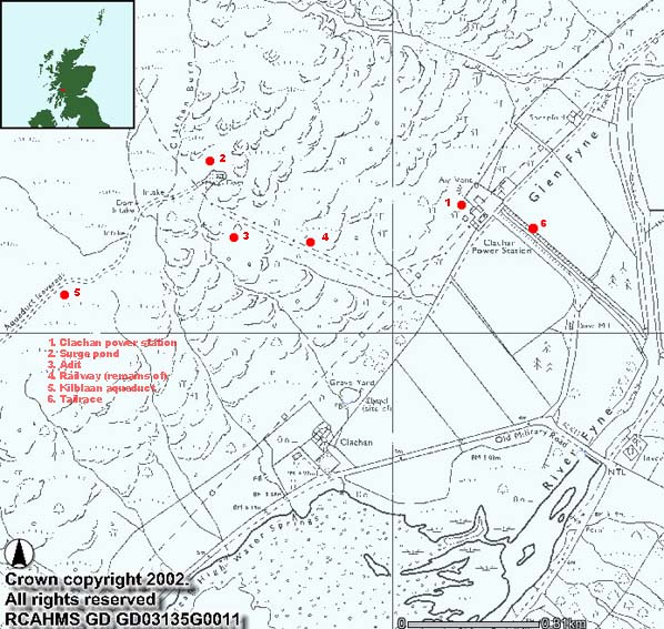
Illustration: Clachan Area Map
Illustration by: Canmap, additional legend Mike Ross
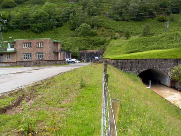
Photo: Clachan power station
Photo by: Mike Ross
The map below is an imagemap - click on the area you wish to explore
(Clickable areas are highlighted with a red background)
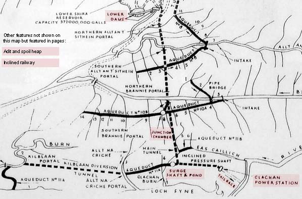 . .
Photo: Map of Lower Shira scheme
Photo by: Mike Ross
Home Page
Last updated 5th March 2003
Style © 1998-2001 Subterranea Britannica
Words and images © 2003 Michael J. Ross

|