The above is an image map, use it to navigate the site. Best viewed at 1280 x 1024 using any browser.
Clachan Power Station - Surge Pond
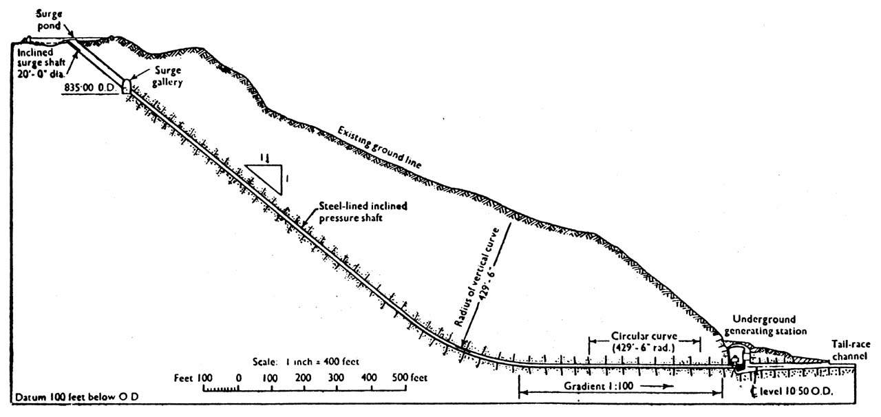
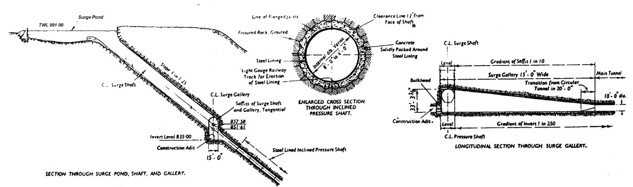
Illustration by: Scanned by Mike Ross, from 'The Engineer', April 1956 A more detailed illustration of the area of the surge shaft, pond, expansion
gallery, and construction adit (this is really best viewed at high-resolution; click on the image and
a high resolution version will be displayed):
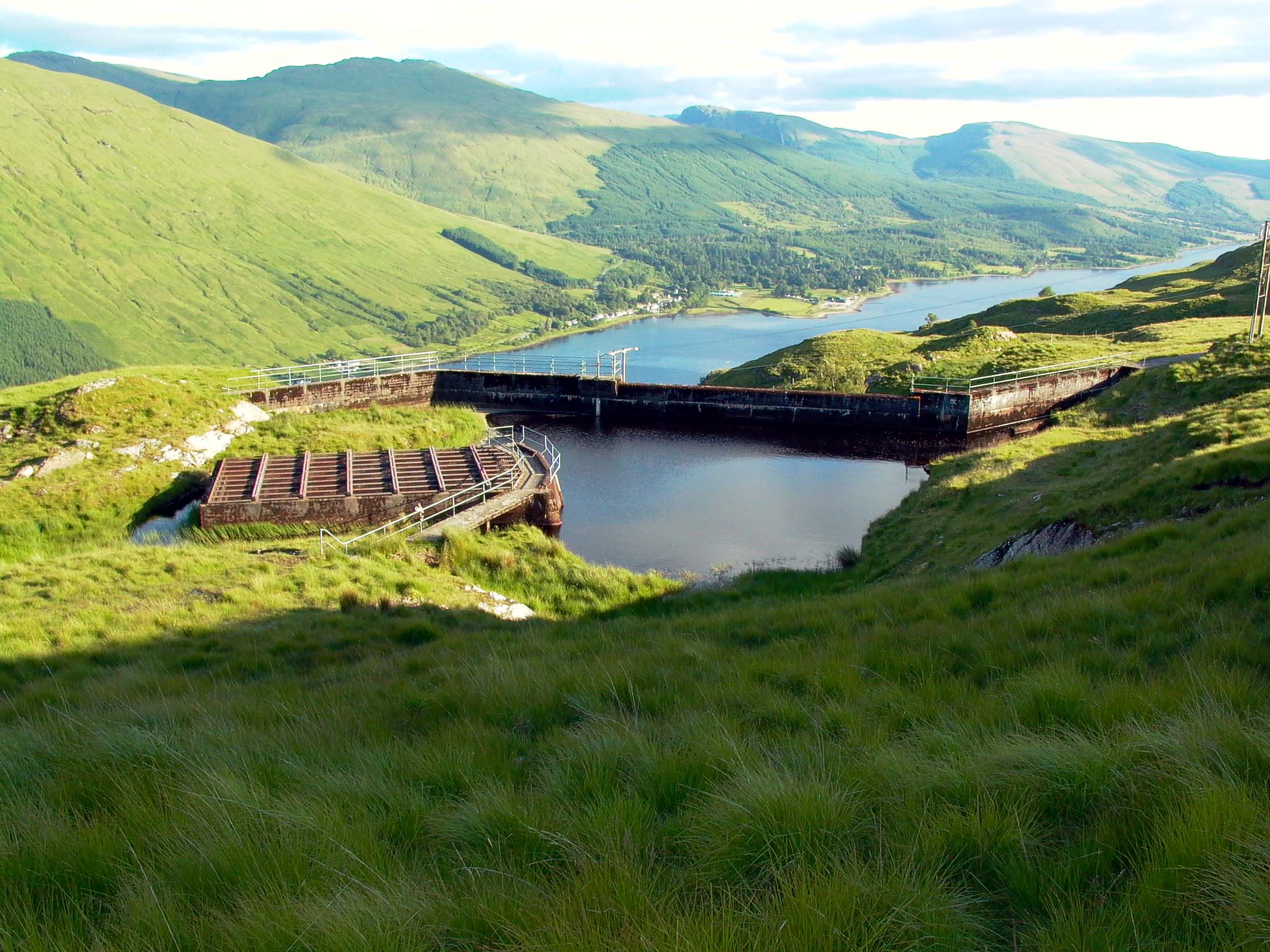
Illustration by: Scanned by Mike Ross, from 'The Engineer', April 1956 A General view of the surge pond, high on the hillside above Loch Fyne.
A slight hollow closed by a small dam, at the right side of the pond is
the end of the aqueduct bringing water from the Kilblaan catchment. The
top of the surge shaft itself is below the large concrete sructure covered
with metal joists and grille.
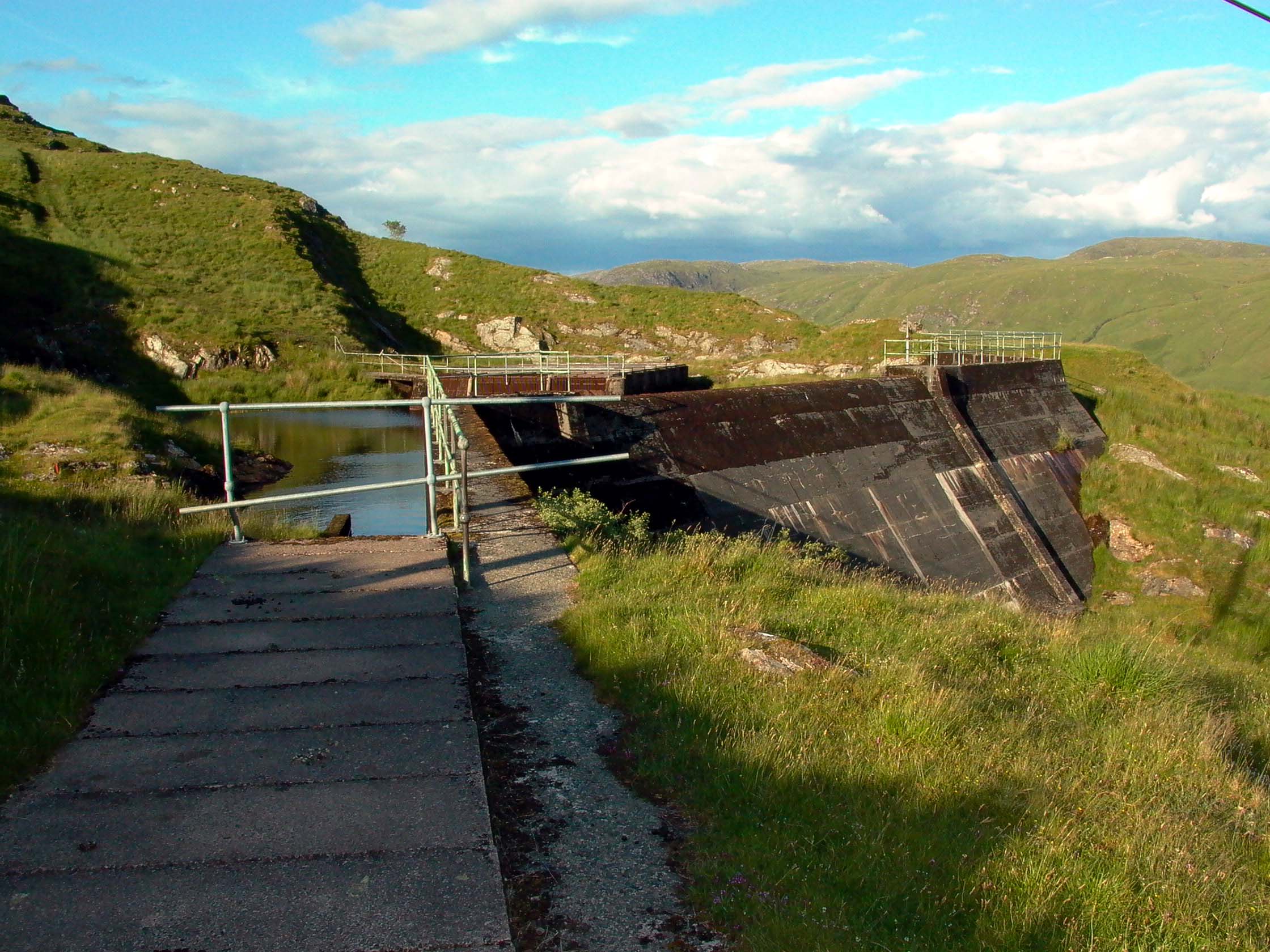
Photo by: Mike Ross Another view of the surge pond, taken from on top of the Kilblaan aqueduct,
which is flowing beneath the concrete slabs.
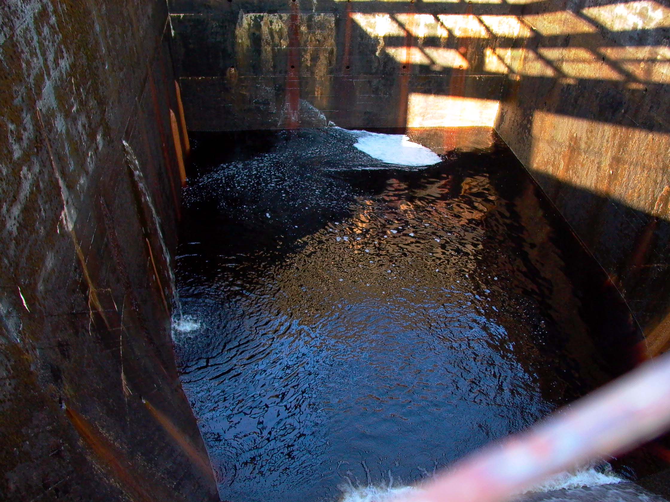
PPhoto by: Mike Ross This view is taken standing on the concrete structure atop the surge shaft,
looking through the grille. The shaft was in fact surging on the occasion
of this visit, the water level rising and falling with a period of approximately
5 minutes. Here it is at the top of the surge...
Photo by: Mike Ross As the level drops, the top of the shaft becomes visible...
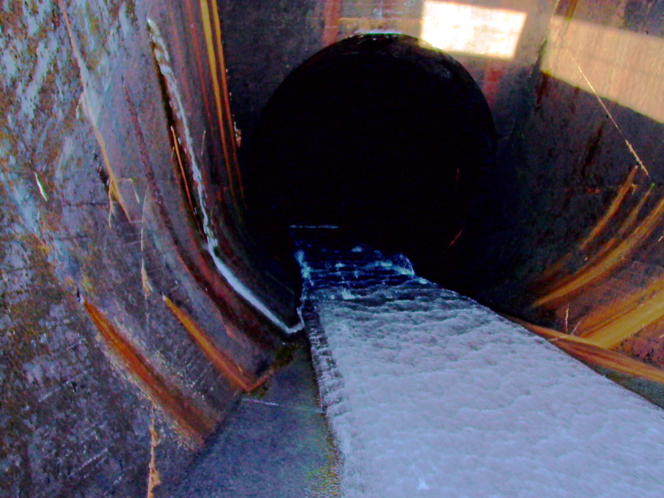
Photo by: Mike Ross ...now the water is at its lowest level, perhaps 60' down the shaft. The
cascade of water flowing down the shaft represents the inflow from the
Kilblaan catchment.
Photo by: Mike Ross Home Page Last updated 5th March 2003 Style © 1998-2001 Subterranea Britannica Words and images © 2003 Michael J. Ross
|