The above is an image map, use it to navigate the site. Best viewed at 1280 x 1024 using any browser.
Deanie Power Station - Monar Dam
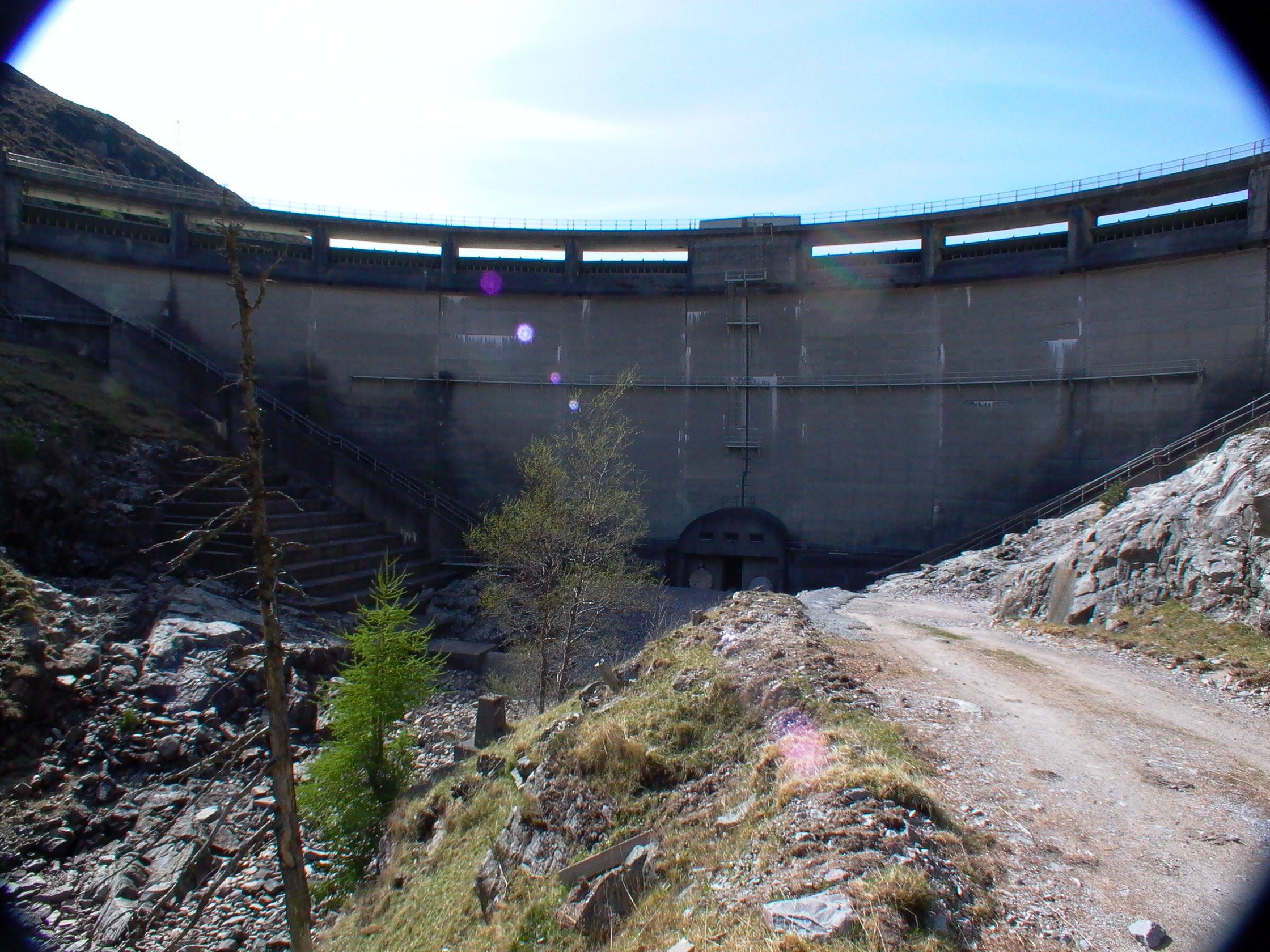
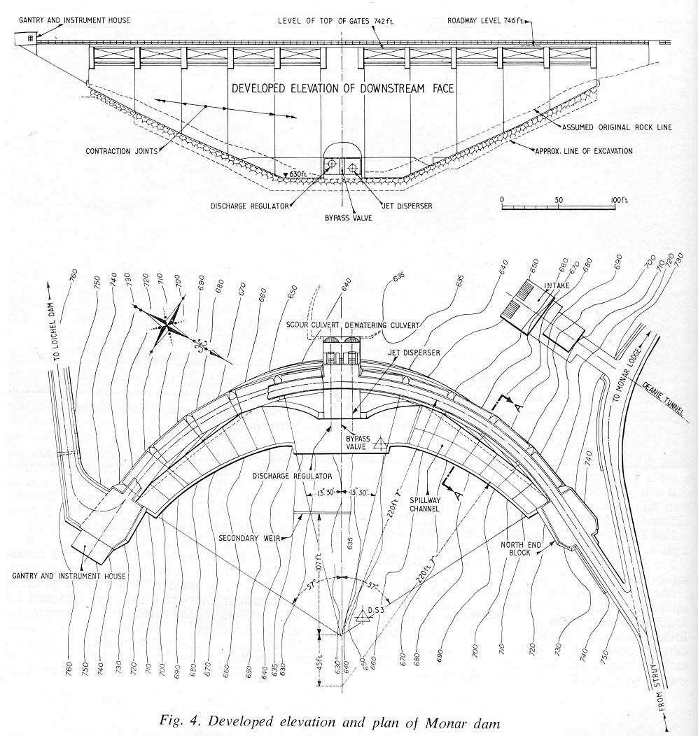
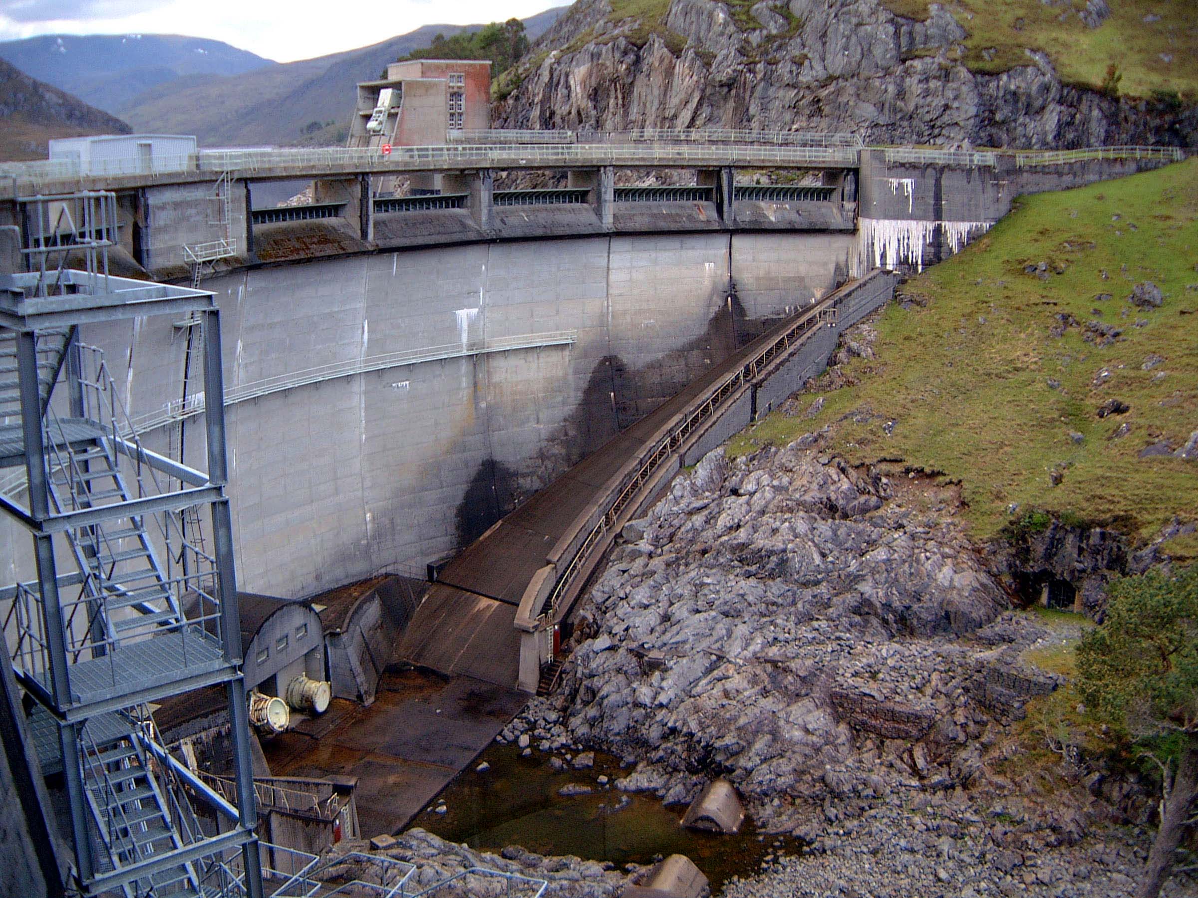
Photo by: Mike Ross The curve is also very evident from behind... Photo by: Mike Ross A couple of engineering drawings: Photo by: Scanned by Mike Ross, from 'Water Power' February 1964 A cross-section... Photo by: Scanned by Mike Ross, from 'Water Power' February 1964 The left abutment. Abutments are clearly very important to an arch dam:
these were most carefully investigated. Note the tunnel entrance in the
lower right of the image: Photo by: Mike Ross This adit was driven before construction started, to explore the rock in
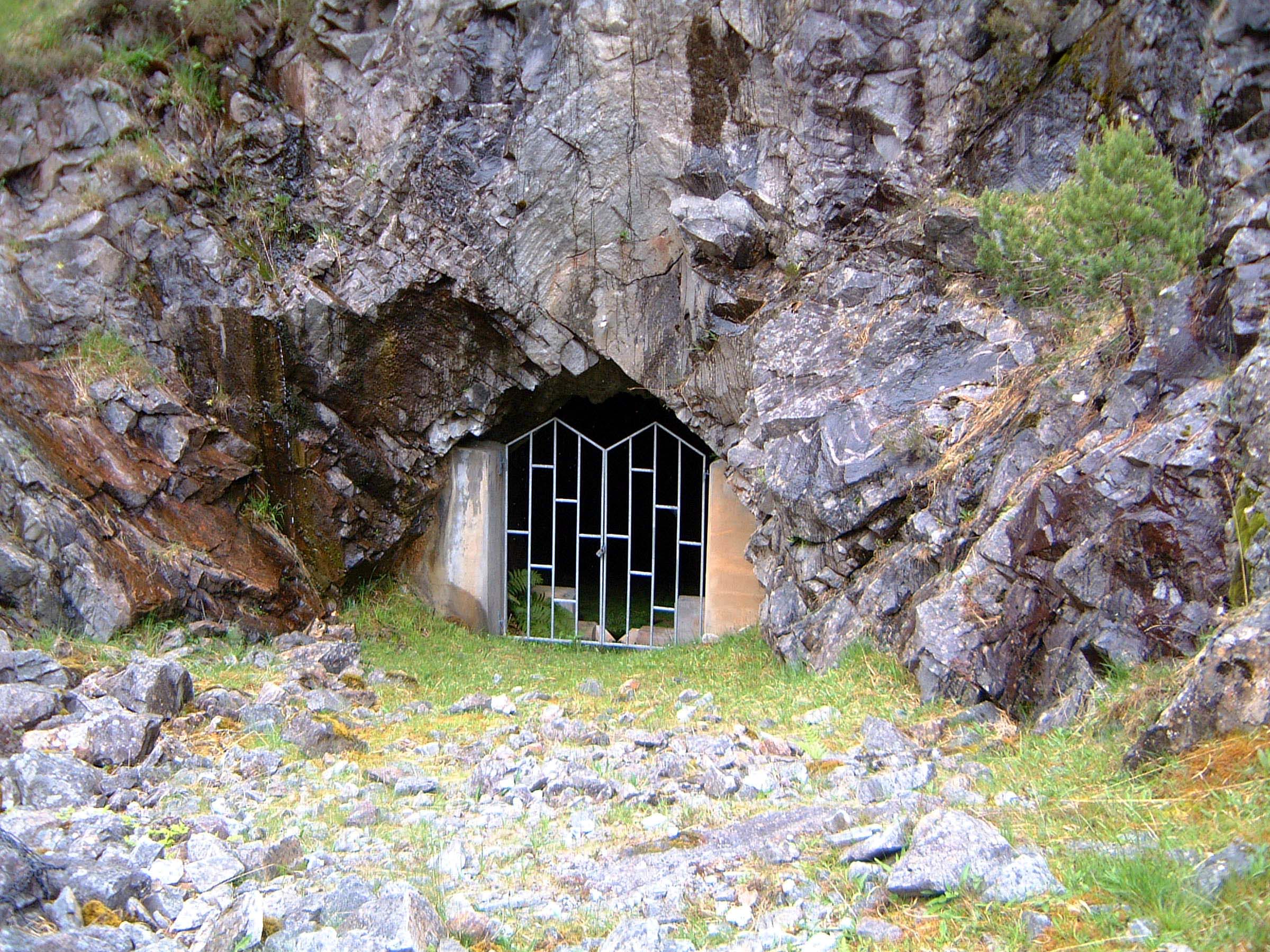
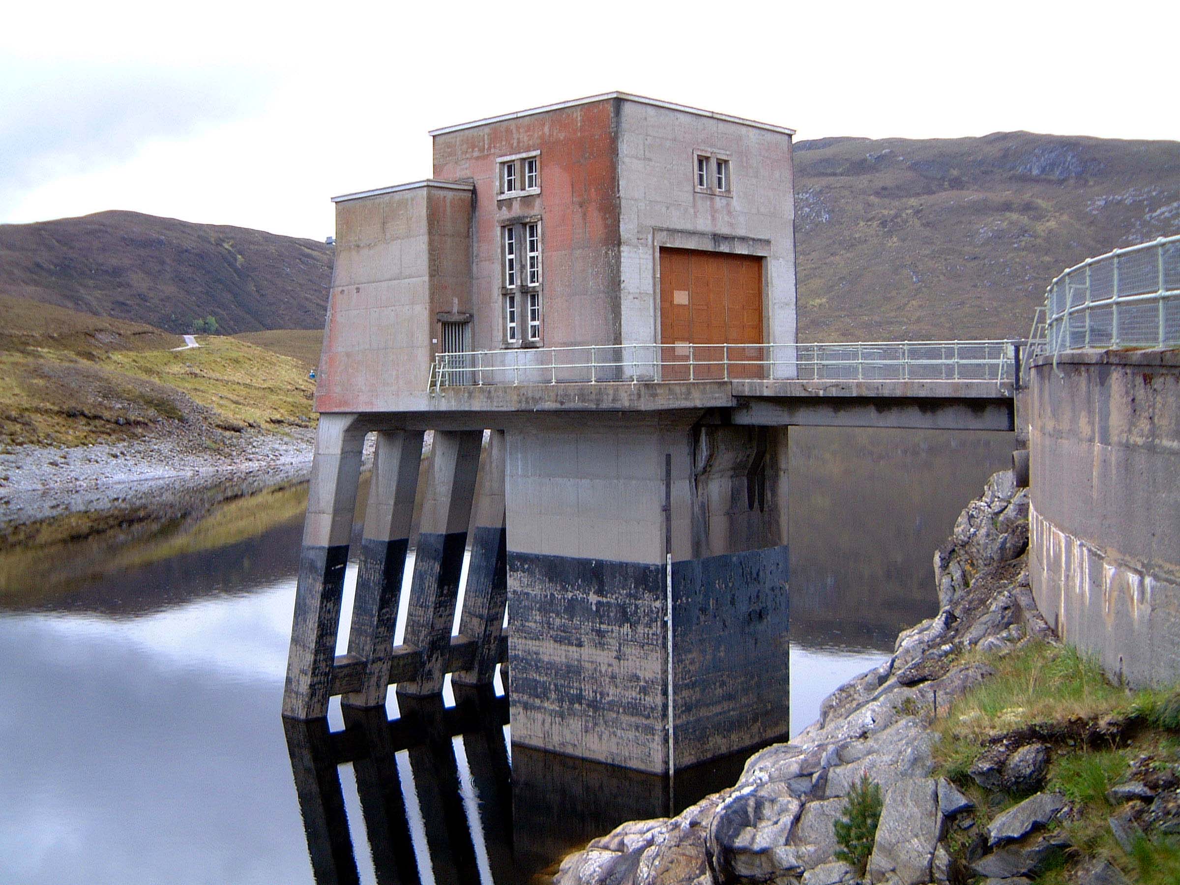
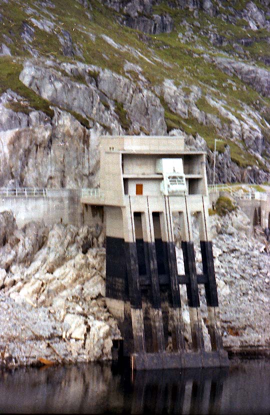
the left abutment and ensure that it would bear the forces involved. Photo by: Mike Ross The right abutment - and another exploratory adit. Photo by: Mike Ross Adjacent to the dam is the intake tower for the Deanie tunnel. The intake
itself is deep underwater, and is controlled by a single roller gate. The
four sloping concrete columns in front of the intake tower carry the rails
for the screen rakes; there are screen to prevent debris from entering
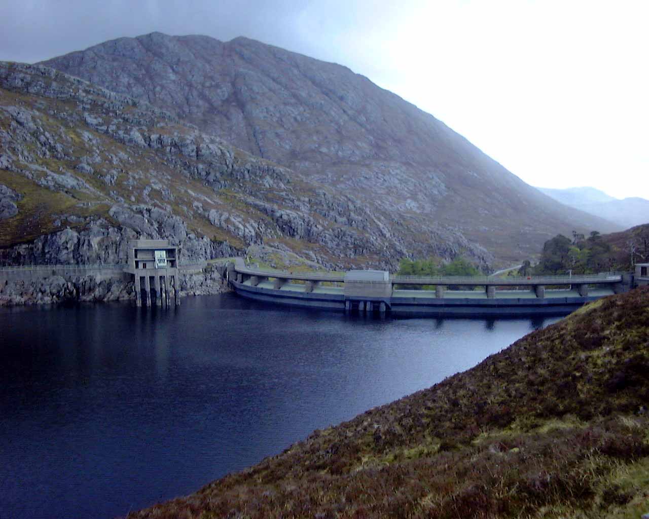
the tunnel, the screens have to be raked clean from time to time. Photo by: Mike Ross The same tower, during a period of exceptionally low water many years ago.
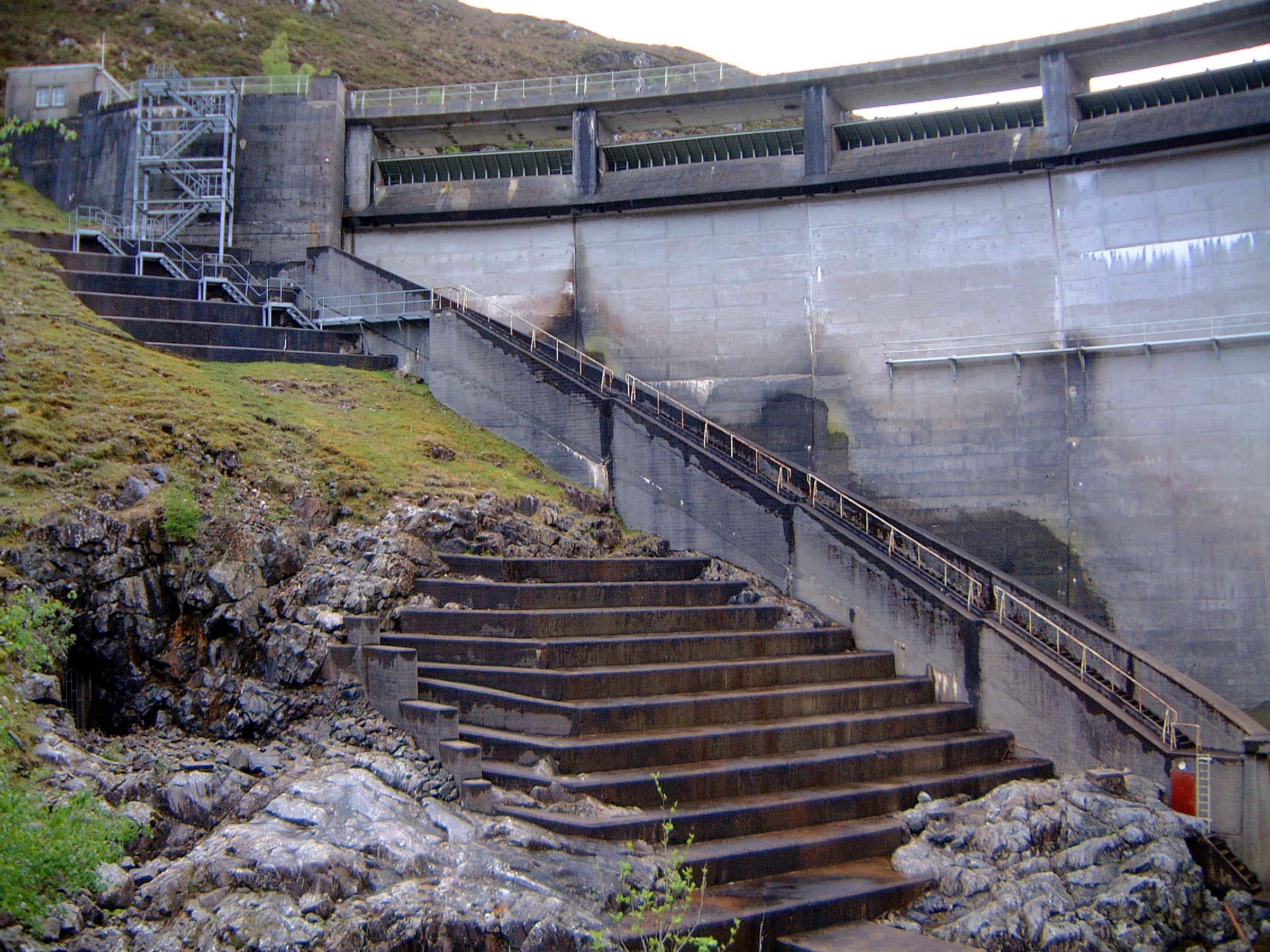
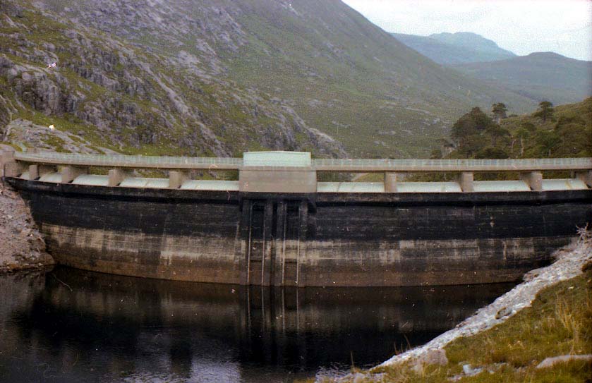
Still well short of exposing the tunnel intake; shows how deep it is! Photo by: Mike Ross The rear of the dam during the same low-water period. The curve of the
structure in the vertical as well as the horizontal plane is very evident
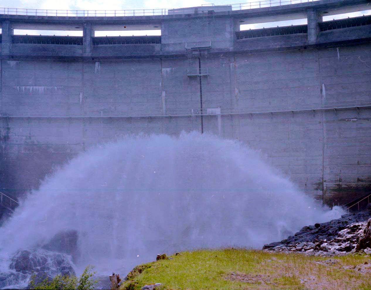
here - you can *feel* the dam arching against the water pressure. Photo by: Mike Ross There's normally no flow in the river immediately downstream of Monar dam;
compensation water is released instead into the Uisge Misgeach a couple
of miles away. On occasion the valves at Monar are used to release freshets,
however: Photo by: Mike Ross Home Page Last updated 5th March 2003 Style © 1998-2001 Subterranea Britannica Words and images © 2003 Michael J. Ross
|