The above is an image map, use it to navigate the site. Best viewed at 1280 x 1024 using any browser.
St. Fillans Power Station
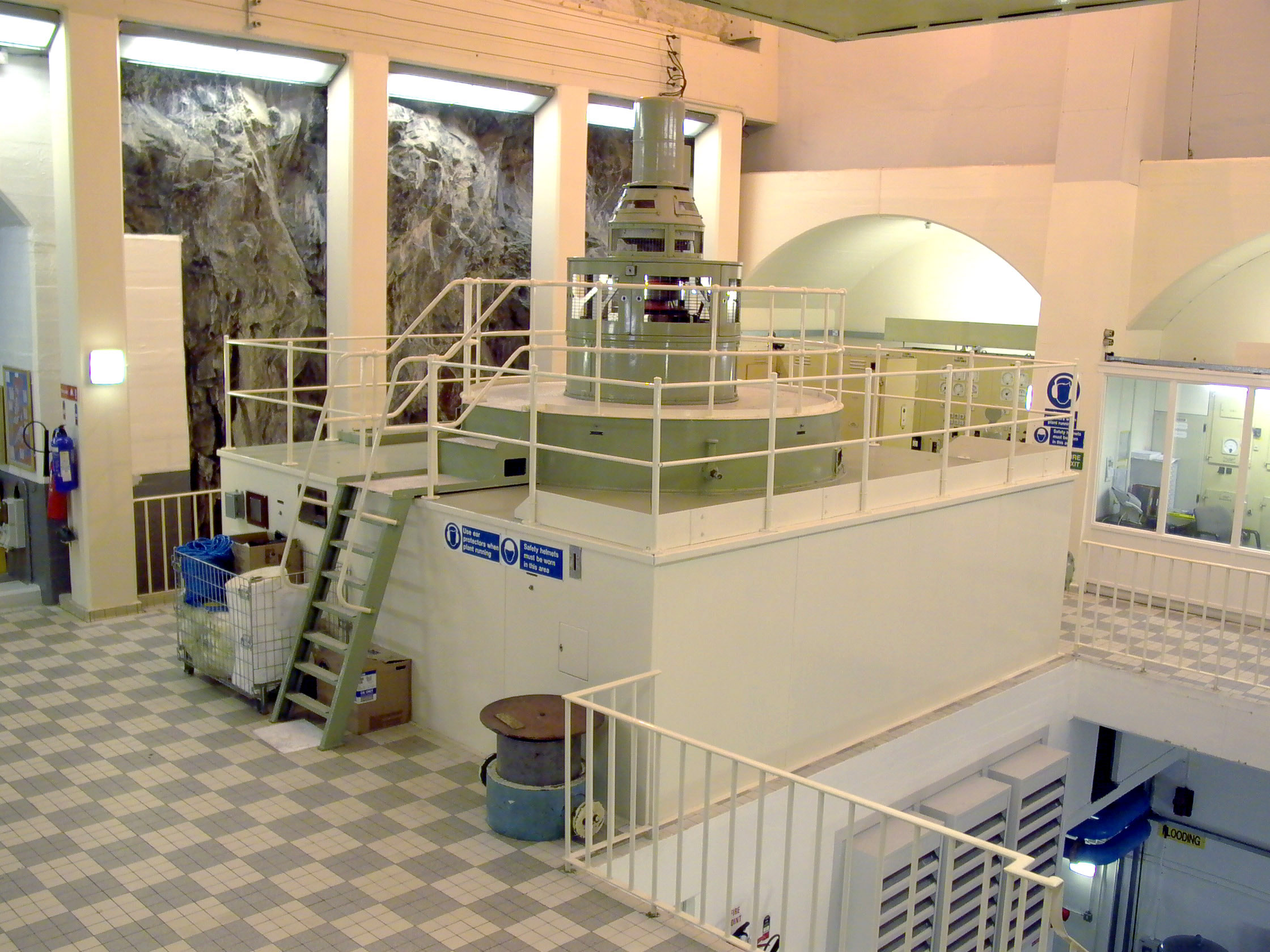
OS Grid Ref: NN 69045 2460 St. Fillans is an interesting and rather pretty underground power station
on the shores of Loch Earn, in Perthshire. Completed in 1957, it's a high
head (830ft) station with the relatively small installed capacity of 21MW,
in a single Francis machine. It's part of a small cascade development in
this section of the Breadalbane scheme; the main storage reservoir at Loch
Lednock receives the outflow from the small, high-level Breaclaich development,
and the outflow from St. Fillans contributes to the water used at Dalchonzie,
a couple of miles downstream. Illustration by: Canmap, additional legend Mike Ross Recently refurbished, the station is in beautiful condition - the brightly-lit
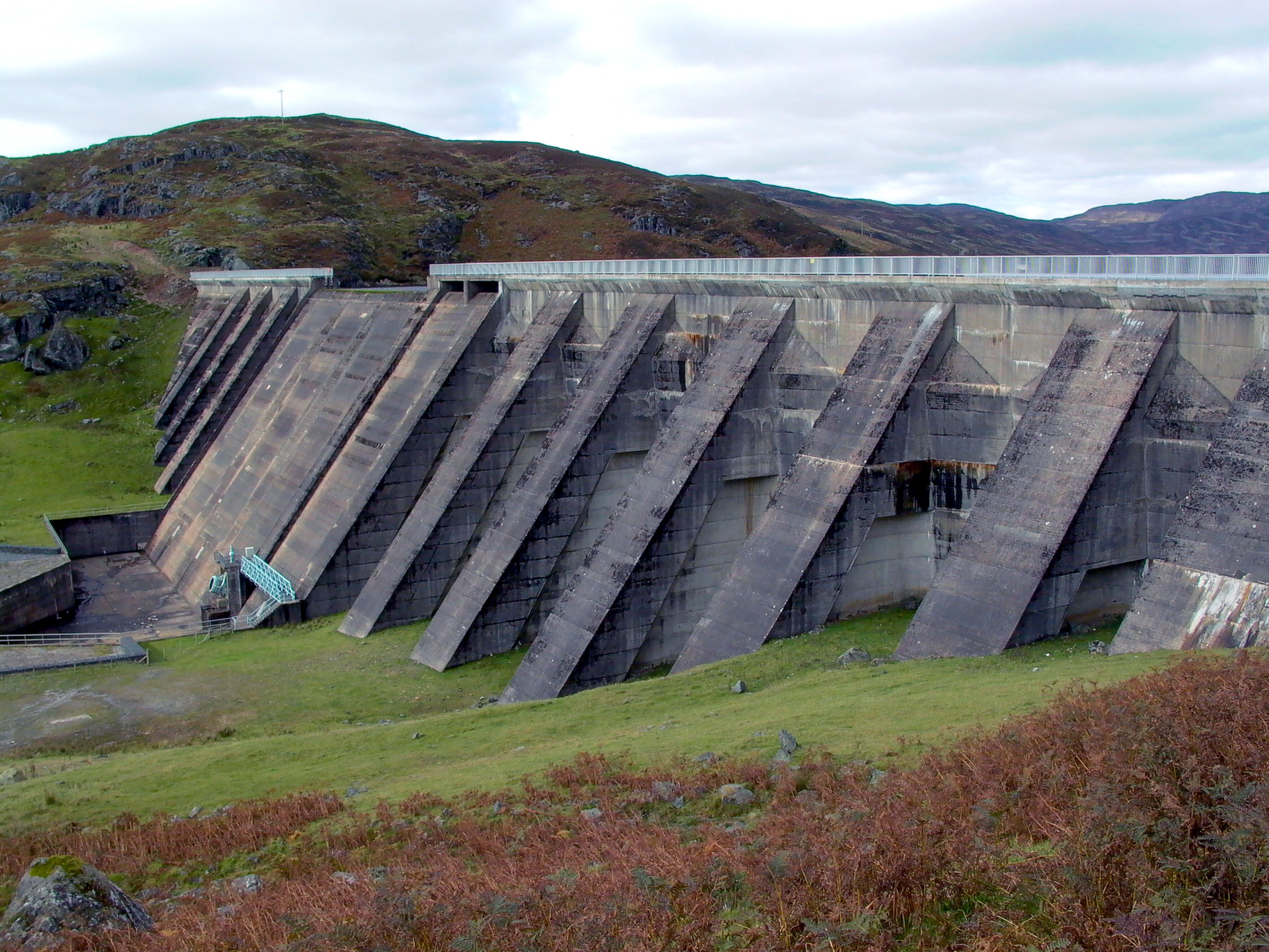
interior and exposed rock walls make it an attractive environment: Photo by: Mike Ross Lednock dam is a substantial structure: Photo by: Mike Ross This map shows the whole scheme. It's a clickable imagemap; click on any
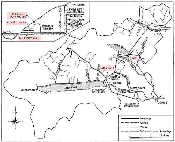
of the pink-highlighted areas to bring up the relevant webpage: Illustration by: Scanned by Mike Ross, from Water Power, January 1956 Home Page Last updated 22th November 2005 Style © 1998-2001 Subterranea Britannica Words and images © 2005 Michael J. Ross
|