Fort South Sutor, South Sutor Cromarty(aka 'The Guns')OS Grid Ref: NH 8005 6707Date opened: 190? Date closed : 1956 (care & maintenance only from 1945) From around the turn of the century to the early 1950s, the Cromarty Firth was one of the more important anchorages for the British Navy, with a large fuel depot (not closed until mid-90s) at Invergordon. [Source: Mike Ross]
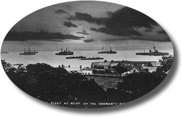
Photo: Atlantic Fleet at anchor, Cromarty Firth, circa 1910. .Also, during WWII there was a significant flying-boat base at Alness. The importance of these facilities lead to the establishment of defensive positions on the headlands ('sutors') guarding the entrance to the firth. I've explored the site at the South Sutor (I grew up near here, the place was always known coloquially as 'The Guns'), the record of these explorations follows:
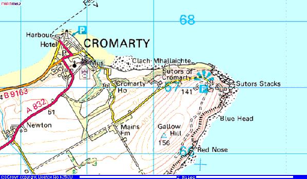
Photo: Cromarty 1:25,000. The Cromarty area. The site described is located between the 'viewpoint' symbol and the 'Sutors Stacks' legend. The image below is a sketch map which gives a good overview.
Photo: South Sutor WWII map. For those without a military background and the extraordinary facility with acronyms this seems to impart, Nick Catford has provided the following helpful decode: CASL Coast Artillery Searchlight
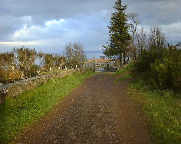
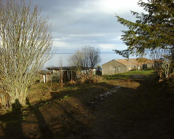
Now on with the exploration! Parking at the viewpoint shown above, we are faced with a gate on the track leading to the site. Surface buildings (presently disused/recent farming use):
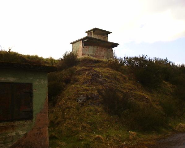
Photo: Approach track. Through the gate, approaching the buildings more closely, the track turns to the left past the building with steel shutters, which was the Fire Command Post.
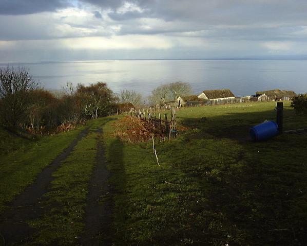
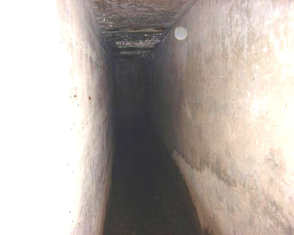
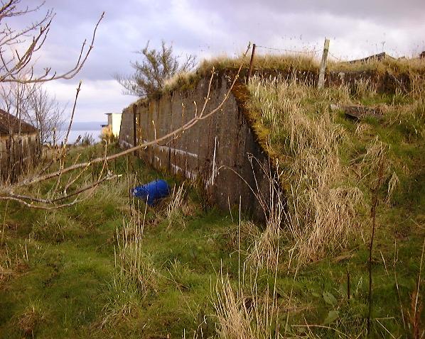
Photo: Approach track. ... and heads downhill towards the main site, which is protected by a high fence of close-set sharp-topped steel stakes (just visible in this picture). On the left of the track as we go downhill...
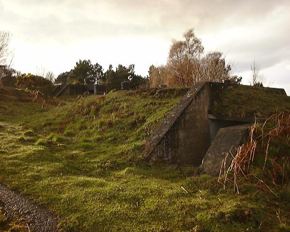
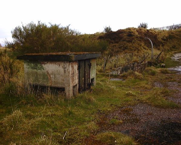
Photo: Approach track. ... we pass a couple of small bunkers with ventilation pipes in the roof and blast-protected entrances. Function unknown... perhaps just personel shelters? They are in the approximate position marked 'RN Engine Room' on the map above, but I couldn't see any evidence for such.
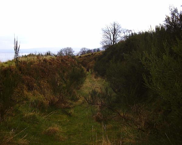
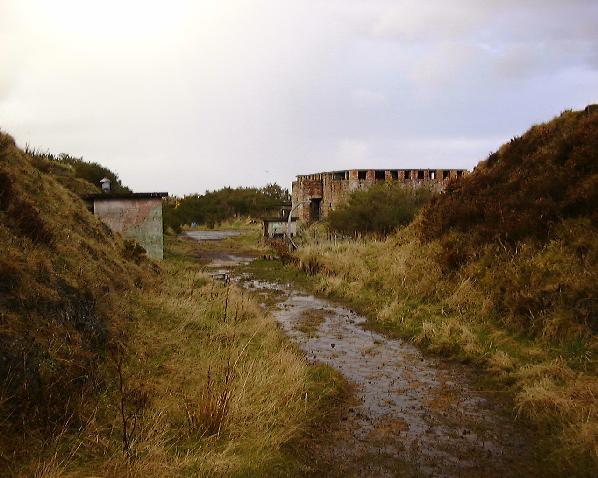
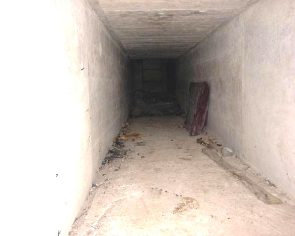
Photo: Bunkers. Past these bunkers, we reach the aformentioned fence, barred by a locked gate. There is however a gap in the fence just to the left of the gate through which the not-too-corporeally-challenged may squeeze. Ignoring the relatively uninteresting surface buildings to the right, we continue to follow the track, now heavily overgrown, which almost immediately turns sharp right into a 'cutting':
Photo: Acces track, cutting. At the end of the section visible above, the track goes round a hairpin bend, clearly shown on the map above, and emerges into the 'business end' of the site:
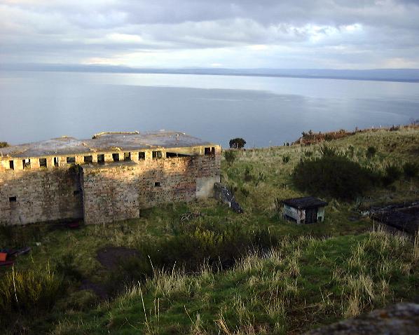
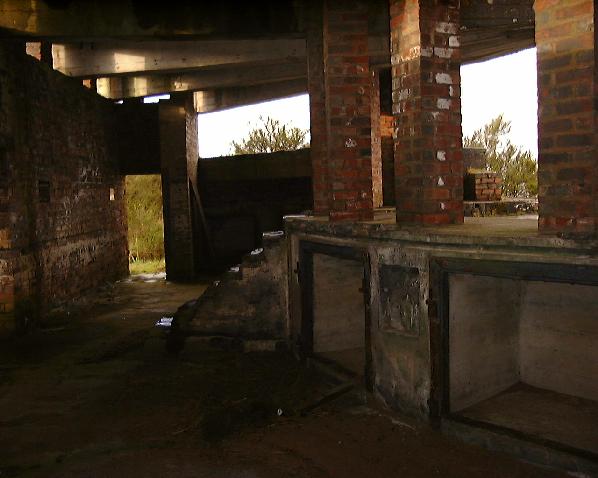
Photo: No. 1. Gun. The structures on the right in the above shot comprise 'No. 1. Gun'. (the structure on the left is identified as 'R.A. Store'). According to CANMORE(2) the emplacements were 'armed with 2 x 6-inch MkVII guns on CPII mountings in November 1939. The battery was placed on a care and mainatainance basis in April 1945 and the guns were removed in 1956.' The small structure on the left clearly shows the fading but well-preserved and graffitti-free camouflage paint typical of much of this site. The large brick structure on the right is the actual emplacement for the gun, we will first look at the smaller structures, the entrance to the underground bits!
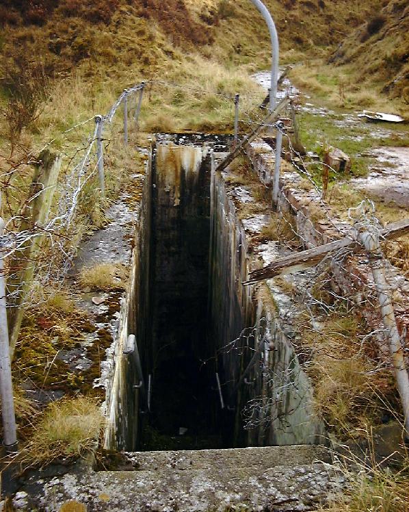
Photo: No. 1. Gun shaft. The small structure is the top of the magazine escape shaft - I was unable to open the doors due to rust & no tools except fingernails (but see later). The disintegrating fencing and crane stanchion around the access stairway to the magazine is clearly visible...
Photo: No. 1. Gun stair. A rather uninviting hole...
Photo: No. 1. Gun stair. Even less inviting in closeup. Cluttered with debris but passable, we proceed downwards and turn left at the bottom to look in past the entrance doors...
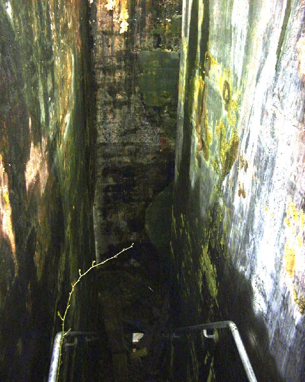
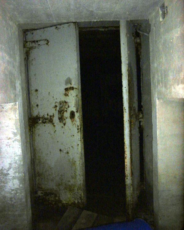
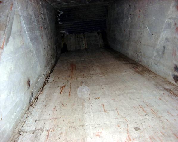
Photo: No. 1. Gun magazine entrance
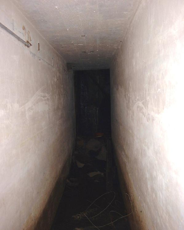
passage. A couple of inches of water on the floor, but the rest of the passage remarkably clean and dry. Proceed carefully along and turn left, the only way to go, to be confronted with...
Photo: No. 1. Gun magazine - crossroads.
... a crossroads. Through the heavy steel doors are the chambers of the main magazine. There are much lower (around 4' 6" IIRC, very stooping walk) side passages to the left and right. Now here is where things get bizzarre: I took the left side passage. It twisted and turned, mainly to the right, few dog legs, few more turns, and eventually... emerged back at the same place as the right side passage! I swear there were no features, turnings, side-passages, or shafts, with the single exception of a *very* low (maybe 3') passage leading to a ladder 'obviously' in the escape shaft mentioned above. The whole thing seemed to be an M25 around the magazine, I couldn't and still can't fathom the function. Suggestions on a postcard please...
Photo: No. 1. Gun magazine - side
passage. Looking into the left side passage...
Photo: No. 1. Gun magazine - shaft
access. Looking into the side-passage leading to the base of the escape shaft, ladder visible.
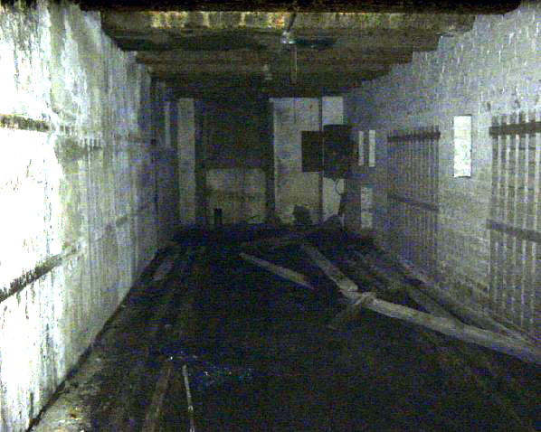
Photo: No. 1. Gun magazine - main
chamber. (Apologies for the poor quality of some of these - brighness and contrast stretched!). Moving through the steel doors into the main magazine, which consists of this chamber and another of similar size adjacent. Pretty much stripped, holes in walls communicate to next chamber. Note the dark area on wall dead ahead, I suspect this was where an ammunition elevator was mounted as...
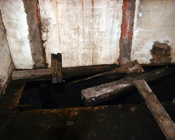
Photo: No. 1. Gun magazine - pit
in floor. ...as there is a deep flooded pit in the floor below (How deep? Thigh deep. Guess how I found that out... I'll bring a better light next time!)...
Photo: No. 1. Gun magazine - elevator
shaft. ... and a slightly-inclined shaft (top covered with corrugated sheet just visible) above. This must lead to the emplacment (logical, as the function of the elevator must have been to raise shell for firing) but in my haste I didn't locate the top of the shaft itself from above (and those corrugated sheets probably aren't too sound, I did NOT want to locate the shaft the hard way!!!).
Photo: No. 1. Gun magazine - electrical
cabinet? On the right wall nearby is a stripped-out electrical cabinet - perhaps something to do with the elevator mechanism?
Photo: Observation Post. Back on the surface, looking up to the left we see the observation post (BOP on map)... climbing up to it we can look back down to No. 1. Gun below us:
Photo: No. 1. Gun from obs. post.
... and looking half-left, No. 2. Gun:
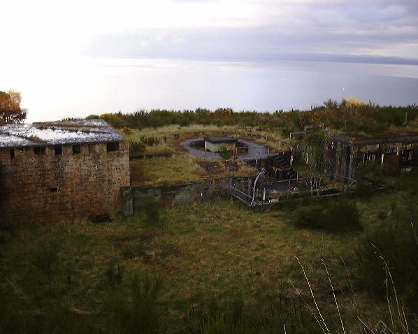
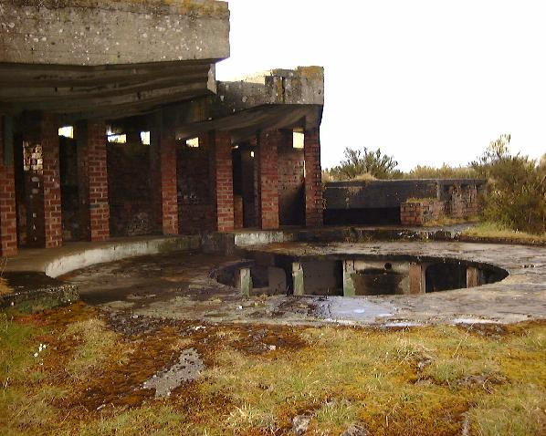
Photo: No. 2. Gun from tower. Moving along we get a clearer view of the No. 2. gun complex:
Photo: No. 2. Gun overwiew. A low building to the right, a stairwell, a shaft-top structure, and the emplacement itself to the left. Pretty much similar to No. 1. Gun, but the layout is slightly different. In more detail:
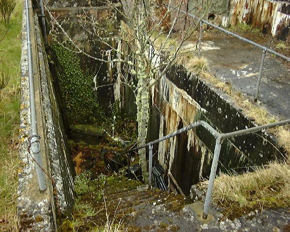
Photo: No. 2. Gun stairwell. Stairwell is wider, but even more overgrown and debris-filled... wonder how long that tree has been growing? At the bottom:
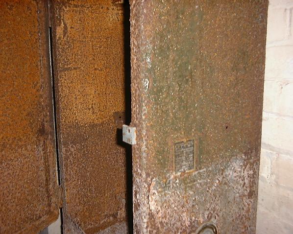
Photo: No. 2. Gun blast door. Blast door partially buried and *very* firmly rusted closed. No lock. Return with crowbar or maybe even some bang... however there is another route: the shaft:
Photo: No. 2. Gun shaft in old 9.2"
emplacement. The shaft for the No.2. Gun magazine is set in this concrete depression (compare the identical structure for No. 1. Gun above). According to CANMORE(2), and the map above, this is the site of an earlier, WWI era 9.2" gun. One wonders why the shaft for the magazine is located in the precise centre of the old emplacement? Perhaps the magazine and shaft were already here, having been used for the WWI gun - i.e. the No. 1. Gun and magazine are contemporary WWII structures, but the No. 2. Gun magazine is older. This might explain the differences noted in e.g. the stairwell layout. The shaft doors are not rusted shut on this shaft!
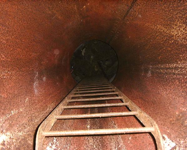
Photo: No. 2. Gun shaft - ladder.
A twenty-foot shaft with a fairly sound-looking ladder... next time, if I have a buddy and some rope, yep... this time, alone... nope. Presumably what awaits below is going to be generally similar to No. 1. Gun magazine... unless my conjecture about this magazine being older is true..
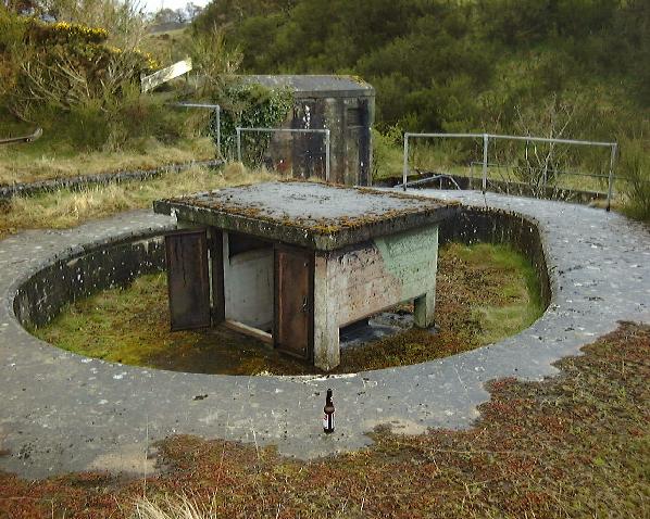
Photo: No. 2. Gun emplacement. The No. 2. Gun emplacement ittself. According to CANMORE(2), the weapon mounted here was a '6-inch MkVII gun on CPII mount'.
Photo: No. 2. Gun emplacment. The interior of the emplacement.
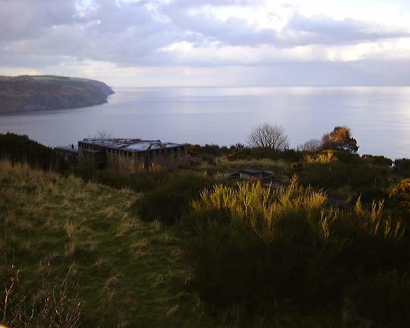
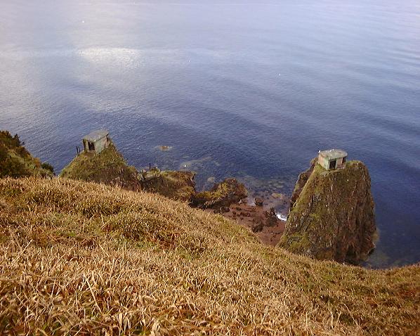
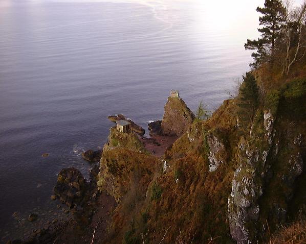
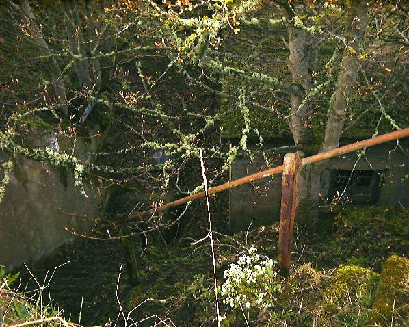
Photo: cliff base searchlights. Carefully approaching the cliff edge beyond gun 1, it's possible to get a view down to the emplacements on the stacks at the base of the cliffs... these were used for searchlights according to CANMORE(2), the map above, and OTHERS(3)... must have been an 'interesting' posting on a wild stormy night!
Photo: cliff base searchlights. Moving round the headland gives us another view of these emplacments. Must have been a hell of a job building there! According to the map at the top of this page, access was via a path/stair constructed down the face of the cliff. According to WARE(4) who visited this site and found the stair (which I failed to do), as of 2001 the steps are missing in some places, unsafe in others... access to the foot of the cliff is not possible without a rope and gear. Speaking of rope...
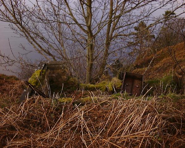
Photo: ?winding house?. ... I found the remains of a small brick structure, together with rack/gear-type ironmongery on the cliff top, in direct line with a gulley pointing right at the western searchlight battery... which also has some kind of ?steel? gantry or stanchion next to it - visible in the one of the pictures above. My conjecture is that the above structure was a winding house for a blondin/aerial ropeway-type device, probably used during construction of the searchlight battery and/or for haulage of equipment during the operation of the battery. Walking back up the road, I noticed an odd structure:
Photo: ?water/fuel tank?. It had no doors that I could find... figured it must be a water tank, or maybe a fuel bunker... explored downhill and found a well-concealed sunken building not far below:
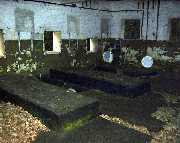
Photo: engine house. This is really sunken, as in a deep pit with a flat floor and a building built in it... looked inside...
Photo: engine house interior. Ah. Obviously an engine house. Marked as such on the map at top of page. Heavy concrete beds for the frames, holes in the wall for intake and exhaust, marks on the walls indicating where instrument boards were once mounted? It has also been suggested by TYSON(5) that these marks were more likely the result of mountings for water tanks, perhaps header tanks for the engine cooling systems.
That's about all I had time for. I'll certainly return there armed with GPS and tape measure for a proper survey, and I'd like to do some more research on the history of the place... I know very little about when it was built and what went on there, beyond what can be inferred from the remaining structures. Any information, hints, comments, advice, corrections of terminology most welcome - email Mike Ross The only data I've found on the web is a page which states that Norwegian troops manned this fort for a period during WWII. Other sites in the area include the remains of a Chain Home Low station on the hilltop above the battery at NH 8064 6692 (foundations only) and another WWI battery with magazine in reportedly (CANMORE(2) and CATFORD(6)) good condition at NH 8085 6727. I've just glimpsed some of the WWI battery through the bushes with no time to follow-up, I'll do a complete survey and pictures of that on my next visit to the area (April 2002?). References: (1) Map from Jeff Dorman, via Nick Catford (pers. com.) (2) CANMORE is the Ancient Monuments Commision search engine at http://www.rcahms.gov.uk/ - select 'Carnmore', register, and search on 'South Sutor'. (3) Nick Catford, (usenet), private correspondance (email) (pers. com.) (4) Robin Ware (pers. com.) (5) Hugo Tyson (usenet) (6) Nick Catford (usenet)
Home Page Last updated 14th February 2002 Style © 1998-2001 Subterranea Britannica Words and images © 2002 Michael J. Ross, except as noted.
|