The above is an image map, use it to navigate the site. Best viewed at 1280 x 1024 using any browser.
St. Fillans Power Station - Lednock Dam
OS Grid Ref: NN 69045 2460 Lednock dam has created an artificial loch, Loch Lednock, which provides
the storage for St. Fillans power station. It's reached by a public road
up Glen Lednock, from Crieff. The last mile or two of the road is private
and gated, but the gate is not locked and there is no objection to driving
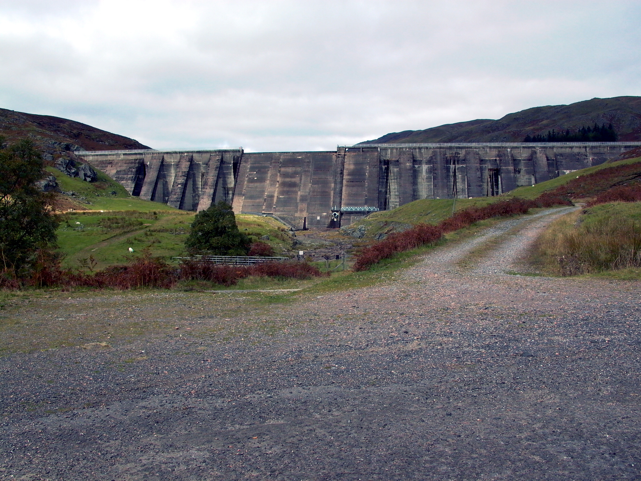
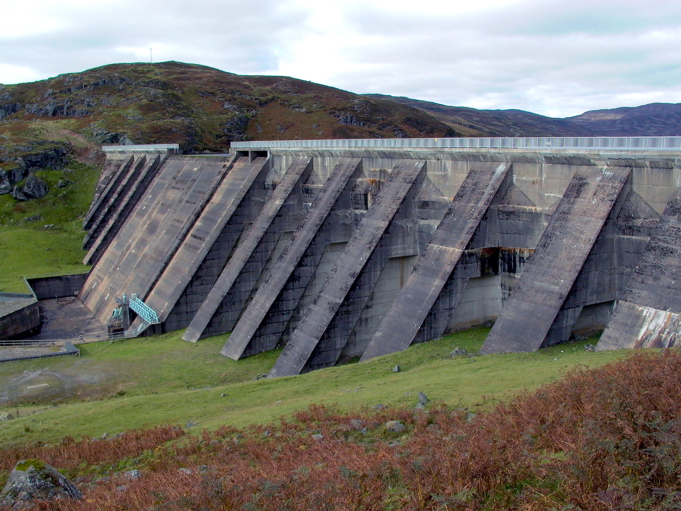
up the road to the dam. Photo by: Mike Ross Lednock dam is a substantial structure, 133ft high and 900ft long. It's
one of only two diamond-headed buttress dams in Scotland - the other is
at Errochty. Special attention was paid to the design of this dam, as it's
close to the epicentre of occasional earth tremors on the faults associated
with the Highland Boundary Complex, which passes close by. Photo by: Mike Ross One unusual feature of Lednock dam is the walkway - obviously only usuable
when water is low! - which runs across the rear of the dam, behind the
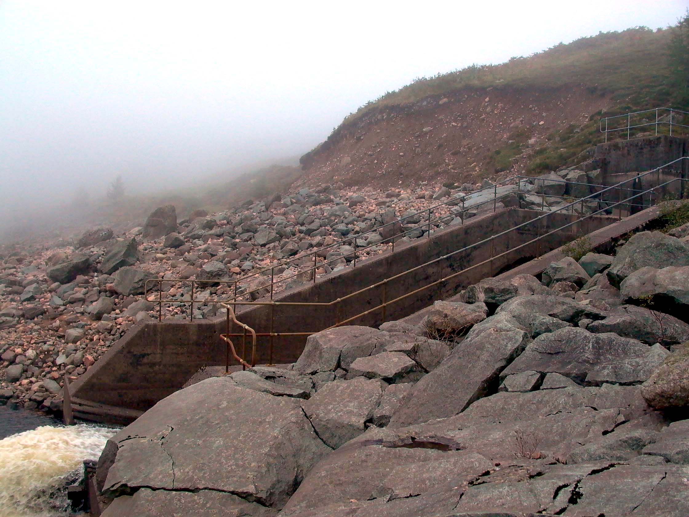
spillway: Photo by: Mike Ross Looking down Glen Lednock from the crest of the dam: Photo by: Mike Ross Looking back to the side of the loch, there's a tunnel outlet a couple
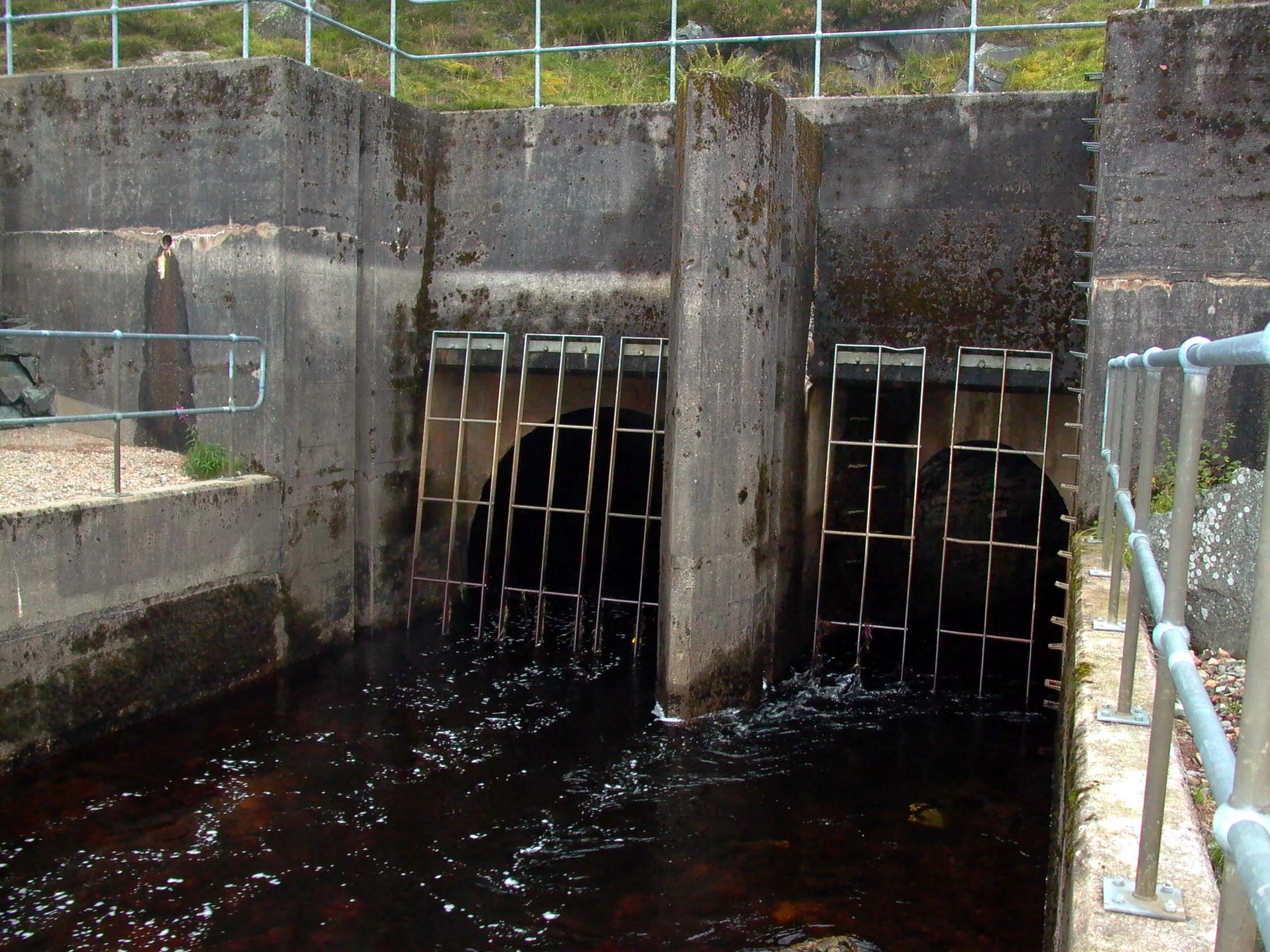
of hundred yards upstream of the dam: Photo by: Mike Ross Notc much to see in high water conditions: Photo by: Mike Ross But in low water, it looks like this: Photo by: Mike Ross It's actually a double outlet; there are two tunnels. The right-hand tunnel
is relatively short - only just over a mile - and intercepts the waters
of the Invergeldie Burn, which would otherwise flow out of the catchment
area. The left-hand tunnel is much longer - over three miles - and brings
the water from the River Almond, over the hills in the next glen to the
North. Photo by: Mike Ross When the water is low, the combined outfall flows down a waterslide into
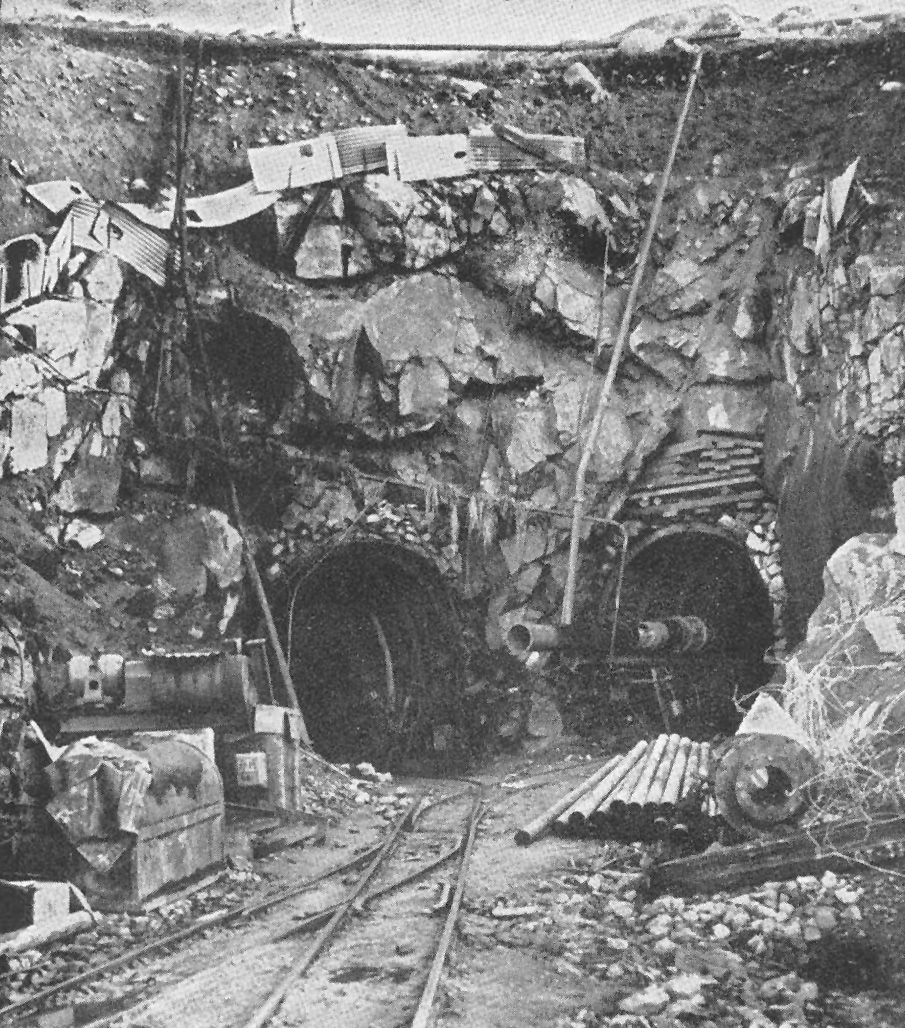
the loch: Photo by: Mike Ross The twin tunnels above under construction: Photo by: Scanned by Mike Ross, from Water Power, January 1956 Finally, a look up Loch Lednock. The white building in the middle distance
is the gatehouse for the tunnel to St. Fillans. Just visible in the far
distance, at the head of the loch (easy to see on the high-resolution version
- click the image to see this) is the small Breaclaich power station, which
takes water from a high-level catchment to the South of Loch Tay, and discharges
into Loch Lednock: Photo by: Mike Ross Home Page Last updated 27th November 2005 Style © 1998-2001 Subterranea Britannica Words and images © 2005 Michael J. Ross
|