Mullardoch Dam & Power Station

OS Grid Ref: NH 22264 30950
Date opened: 1955
Date closed : Operational
Mullardoch is the largest dam built by the Hydro Board. Not the highest
- that's Sloy - but the largest; 2,385 feet long, by 160 feet high.
Loch Mullardoch, the reservoir formed by the dam, represents the considerably
enlarged conjoined loch formed from the union of the pre-dam Loch Mullardoch,
and Loch Lungard, which lay to the west. It is the main storage reservoir
for Fasnakyle power station, which lies in Glen Cannich, to the south.
Water from Loch Mullardoch is led through the mountains dividing the two
glens by a 17,000 foot tunnel, which discharges into Loch Benevean. From
Benevean, a further tunnel takes the water to the power station at Fasnakyle.
The reason for this two-stage arrangement is simple: amenity. Loch Benevean,
and Loch Affric (to the west) lie in an area of great natural beauty. It
would have been impolitic to propose building a massive dam at Benevean,
grossly enlarging and uniting lochs Benevean and Affric, and providing
the main storage of the scheme there. There would have been enormous opposition
to this, especially since seasonal fluctuations in runoff would have required
considerable drawdown of the reservoir, creating a very unsightly zone
of bare rock along the shore of the reservoir when the water was low.
Instead, a relatively small dam was built at Benevean, which only raised
the level of Loch Benevean by a small amount, and didn't affect the level
of Loch Affric at all. Also, only a very limited drawdown of Loch Benevean
is permitted, minimising the 'tide rim' effect on the shore of the loch.
To keep the level of Loch Benevean within permitted levels during periods
of low runoff, water is supplied from the main storage at Mullardoch.
There is, on average, a difference in level between lochs Mullardoch &
Benevean of 80ft (~25m). To take advantage of this, a small (2.4MW) underground
power station was constructed at Mullardoch as an 'afterthought', after
the completion of the rest of the scheme; the dam and tunnel were completed
in 1952, the power station in 1955. The result is unique in Scotland; an
undergound power station with no tunnel access, just a vertical shaft.
There are 31 images of Mullardoch in the Records, and 4 webpages. They may all be accessed via the links at the bottom of this page. Each link will open in a new window.
Drilldown to high-resolution imagery IS available online for this site
- click on any image, a high-resolution version will open in a new window
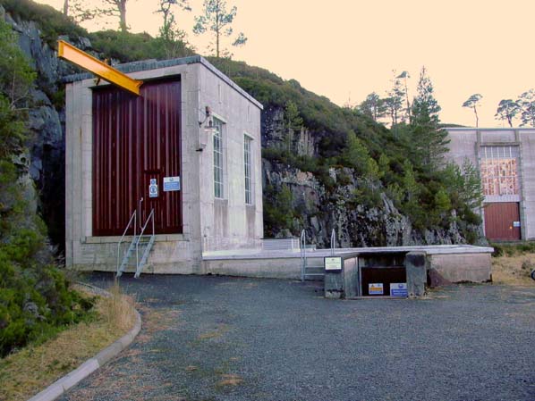
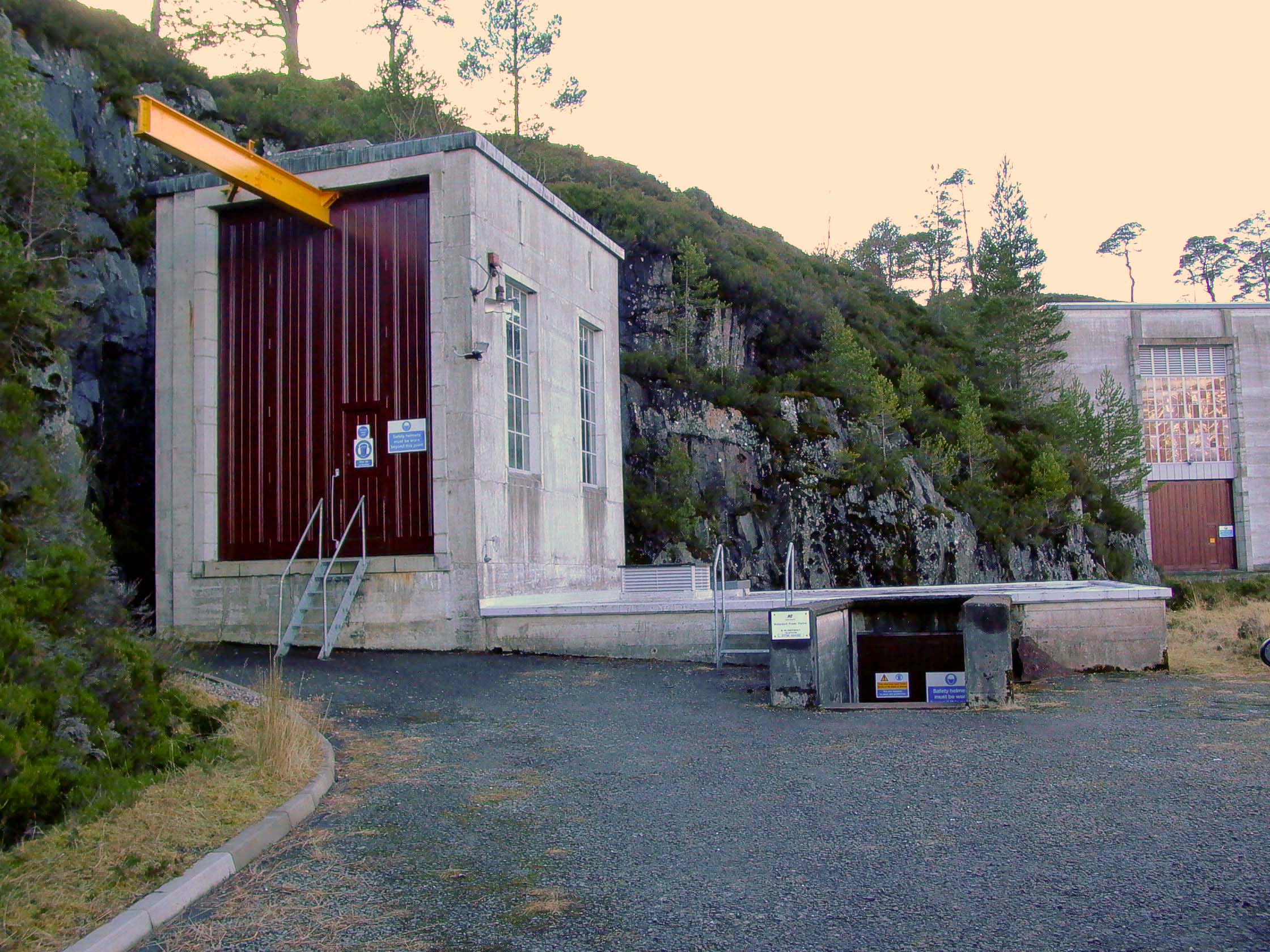
Photo: Mullardoch power station - surface structure
Photo by: Mike Ross
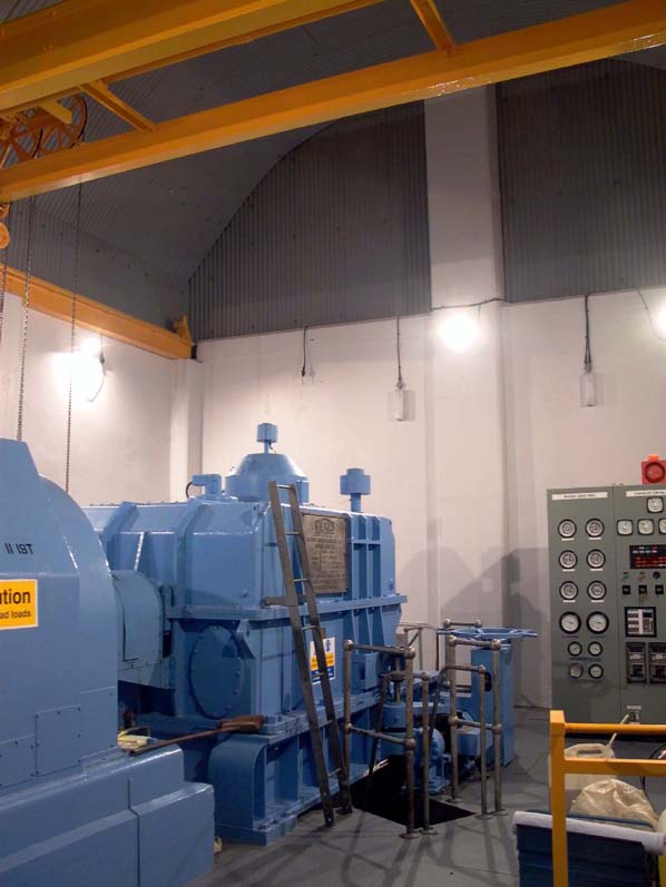
Photo: Mullardoch power station - interior
Photo by: Mike Ross
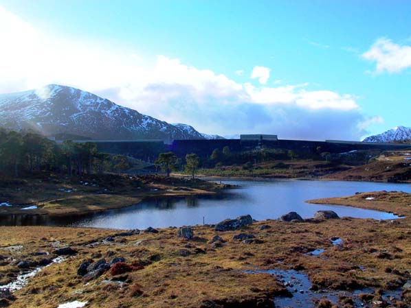
Photo: Mullardoch Dam
Photo by: Mike Ross
Now, the rest of the pages about this scheme:
Click here to read about Mullardoch Dam
Click here to read about Mullardoch Power Station
Click here to see some archive photos from the construction of Mullardoch
Click here to read about The Mullardoch-Benevean tunnel
Home Page
Last updated 5th March 2003
Style © 1998-2001 Subterranea Britannica
Words and images © 2003 Michael J. Ross

|