Inchindown Fuel Depot
OS Grid Ref: NH 68840 74490 (Main Portal)
Date opened: 194?
Date closed : 199?
UPDATED 28/05/06 after a further visit, during which the entire complex
was explored, rephotographed, and Catforded(1)
The Inchindown Fuel Depot is one of a series of five such depots constructed
at various locations around the country during the 1930s, as bombproof
fuel oil stores for the Royal Navy. I had no idea the place existed, until
a chance conversation with my father in 2003 evoked his memory of the workers
who built the place in the 1930s - they earned good money, in many ways
they were the forerunners of the workers who would build the hydro schemes
after the war - but many of them suffered from silicosis... at the time
of construction it was all very hush-hush of course, not all that many
people really knew what was being built.
There's remarkably little information on the net (so far as I can find) about these locations, and none at all about Inchindown. The single exception seems to be Bob Hunts excellent site on the Portsdown Tunnels, which includes information and a very useful plan on the Portsdown fuel bunker.
A preliminary 'raid' on the Inchindown tunnels was quickly organised, and
prelimary pages and pictures were put on the web. Since I was alone, I
didn't take the risk of penetrating the tunnel complex beyond daylight.
A proper penetrating 'raid' and full-blown photographic survey will follow
ASAP. UPDATE 28/05/06 - the tunnels have now been fully explored and rephotographed,
using improved equipment and techniques, and these new pages are the result.
The site was found without any problem thanks to CANMAP (a truly outstanding resource!), and, much to my surprise, it was a 'walk-in'
- entirely unsecured on my initial visit (the main portal looked as though
it had a padlock in some of the original pictures, but in fact it wasn't
actually 'locking' anything!).
At present (summer 2006), the site is fully secured, and I'm in touch with
the current owner. He is a local businessman who bought a lot of ex-MOD
property in this area; the bit he really wanted was the pier at Invergordon,
but the property was a 'job lot' and he had to take it all, including the
tunnels. He's presently trying to figure out a use for them! I enjoy good
relations with him (my most recent trip to the tunnels, during which these
pictures were taken, was arranged with him), and anyone who has a *serious*
interest in visiting the tunnels is welcome to get in touch with me, and
I will make representations to the owner.
1. Catforded: (v), after Nick Catford. Underground photographic technique,
involving opening the shutter of the camera, and running around like a
bad mastard in almost complete darkness, repeatedly activating a flashgun.
Inchindown is located approx. 4 miles North of the port of Invergordon:
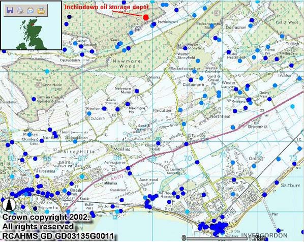
Illustration: Invergordon - Inchindown Area Map
Illustration by: Canmap, additional legend Mike Ross
Detail of the site, which is easily accessible from Inchindown farm. There
are two portals, as at Portsdown. The area identified by me as 'presumed
spoil heap' is actually marked as 'gravel pit' on 1:25,000 maps, but this
is in my view suspect.
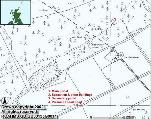
Illustration: Inchindown Area Map
Illustration by: Canmap, additional legend Mike Ross
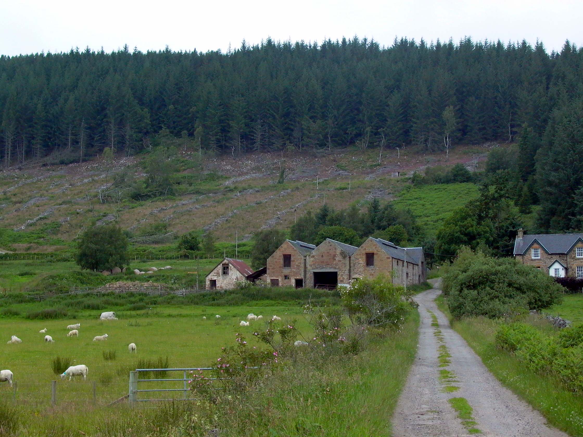
Recent tree-felling has made the site much easier to see, as is clear in
this view from the approach track:
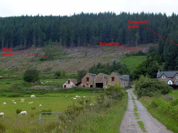
Photo: Inchindown - general view of site from farm track
Photo by: Mike Ross
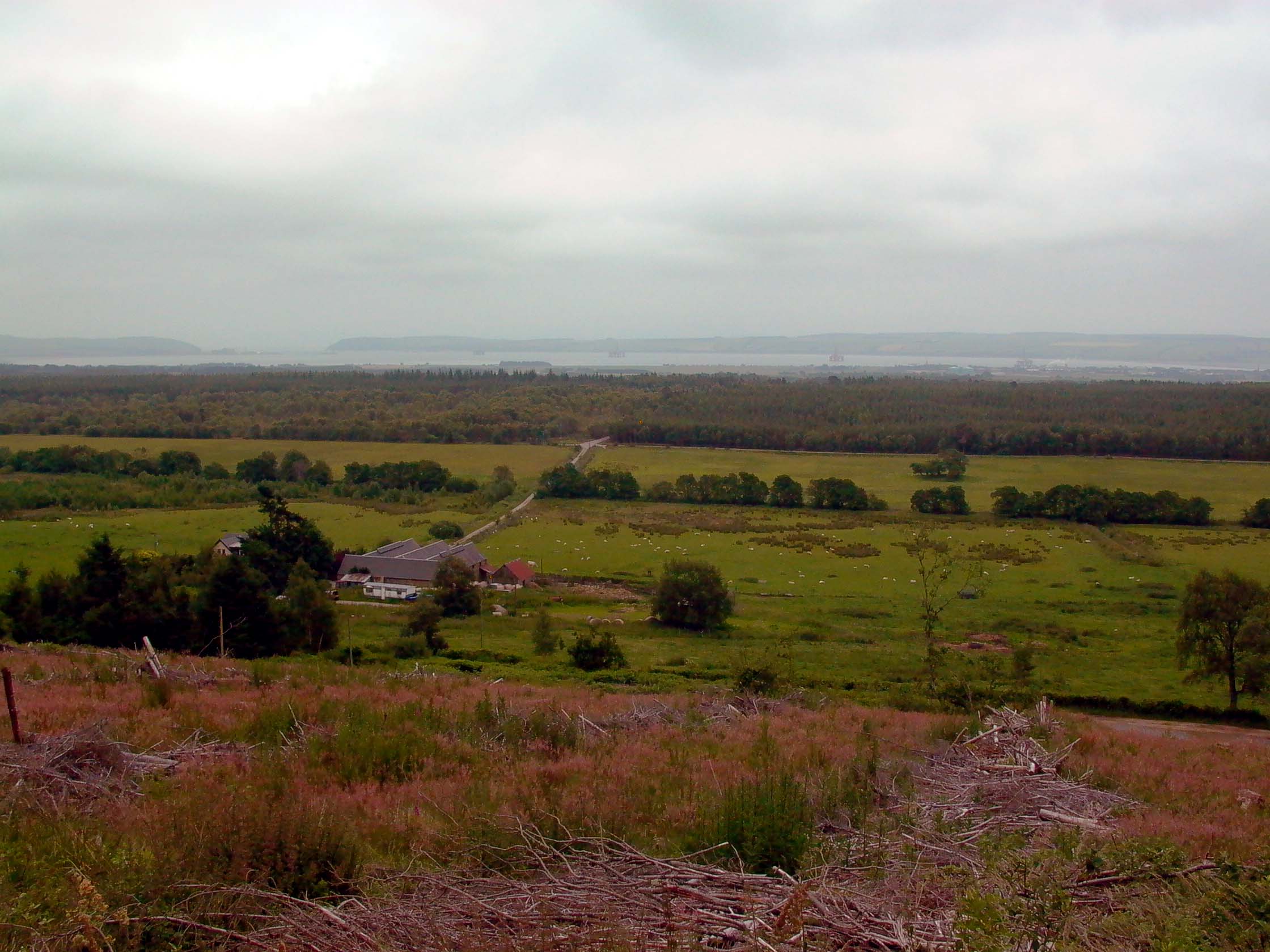
This view from the main portal shows Invergordon in the background, and the Sutors - see my other page on the fortifications at South Sutor
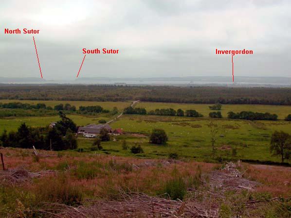
Photo: Inchindown - view from the main portal
Photo by: Mike Ross
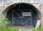
The main entrance portal:
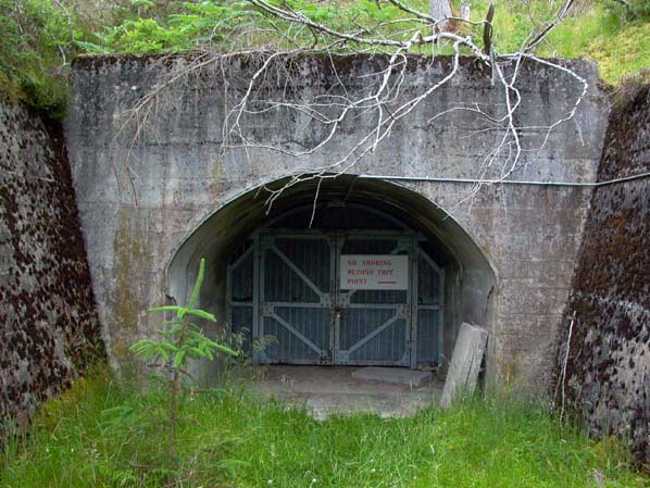
Photo: Inchindown - main entrance portal
Photo by: Mike Ross
This is my corrected sketch survey; I was mistaken in my recollection about
the bends in the tunnels in my first attempt, and I also mistakenly showed
only 5 tanks when there are in fact 6. Finally, some of my conjectures
were in error. I'm still not 100% convinced of the accuracy of this sketch;
the general arrangement is certainly right, but my scale may be slightly
off. In particular, I suspect the tanks should be drawn somewhat closer
together:

Inchindown - Sketch
survey.
Illustration by: Mike Ross
Now that you have (hopefully) enjoyed the overview, you may care to explore
in more detail. There are three further pages, which will open in new windows:
1. The Main Portal and tunnel
2. The Secondary Portal and tunnel
3. The surface buildings
The main and secondary tunnel pages make heavy use of images - around 20
images per page - and may take a few moments to load, even on broadband.
Drilldown to high-resolution imagery IS available online for this site
- click on any image, a high-resolution version will open in a new window
Home Page
Last updated 28th May 2006
Style © 1998-2001 Subterranea Britannica
Words and images © 2006 Michael J. Ross

|